 |
Thursday, 24 July, 1997 -- Spiterstulen - Hyllestad
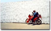
| Departure from base camp at Spiterstulen. |
|
|
When we woke up this morning yesterday's hardships could be felt in our
legs, so no downhill skiing today! :) Actually, it should be just great
to sit on the bike for a whole day and give the legs a good rest. Today's
first little stage was the same 20 km gravel road we went up two days before.
This time I could not help myself. This road was so nice I just had to take
it with some speed, so I left my fellow travelers in a cloud of dust. After
10 km I stopped and let my followers catch up on me. :)
As I expected, it took only a couple of minutes until Niklas - who also
where on an offroad bike - showed up.
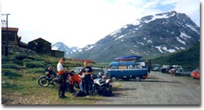
Down
at the base of the 20 km long gravel road leading
up to Spiterstulen. |
|
|
So I threw my helmet back on in a hurry
and followed him down. Back at the main road again, it took several minutes
before Claes had caught up, so Niklas and I used the time to give our bikes
some well needed service (meaning lubricating the drive chains :) and to consult
the map to figure out where to go next.
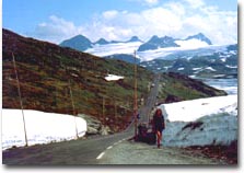
Road
55 through a snowdrift on
Jotunheimen. |
|
|
The goal for today was to get us as far as possible towards the coastal
town Bergen. This meant that we continued south-east on road 55 - at this
altitude an awfully nice little mountain road winding here and there, up
and down, for many many kilometers. If you had been alone on the road it
would have been just a great driving experience.
But unfortunately the traffic was quite heavy with lots of caravans and
caravanettes blocking the road every now and then. But instead you had the
opportunity to enjoy the fantastic mountain scenery where the snow still
could be seen close to the road. In one passage the road went through a
2 meter high snowdrift!
After an hour or so we were down at sea level and Lustrafjord which connects
to Sognefjord - the world's longest fjord.
And this fjord we should now
follow almost all the way out to the ocean. Earlier this day the weather
had been partly cloudy, but as soon as we got the Lustrafjord in sight we
could see a huge thunderstorm only a few kilometers away and in only a few
minutes we would get right into it. Ahead of us we could see how the flashes
of lightning hit the sides of the fjord, and even though we wore helmets
and earplugs, the loud bangs were very clear. As we drove right into it
we looked for a place to take shelter. It was not a very nice feeling to
sit on an unprotected bike whilst in the middle of a thunderstorm.
But we found nothing suitable, only trees to hide under, and that is not an option
during a thunderstorm! After 15 minutes we were through the worst.
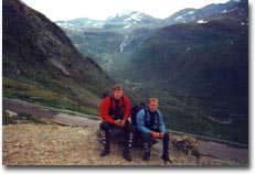
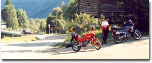
| Stefan and Niklas taking a break. |
|
|
After the cold temperatures up
on Jotunheimen earlier on today, the contrast was very big as we left
the thunderstorm behind us and closed in on Sogndal. Now suddenly a wall
of hot summer air welcomed us again. We stayed in Sogndal between 2.00
pm and 4.00 pm to have some pizza, withdraw some more cash and try and
arrange with accommodation for the coming night. We got as a cabin at
a place called Birkeland Camping, located at the north side of the Sognefjord,
almost at the outlet to the Atlantic Ocean. According to the map, we were
now 170 km and one ferry trip away from our end destination for the day.
So with 4 hours to get there (we had to be at the camping at 8.00 pm at
the latest) we thought we had plenty of time. It's just that it is not
very easy to estimate driving times in Norway with all the serpentine
roads and ferries taking more time than you think.
During the remainder of the day
we headed west along all of the Sognefjord which we had on our left side
almost all the time. About 40 km from Sogndal we had to take a ferry from
Hella over the Fjærlandsfjord to Balestrand. A short crossing of
10 minutes. On arriving at the other side we took the opportunity to fill
up the fuel tanks again.
At a place called Vadheim we turned
left, off from road 55 and onto road 1. 30 km later we arrived at Lavik
where we the next day intended to get on a ferry to cross the Sognefjord.
But now we had to continue another 20 km to get to our camping site. But
now we got struck with the fact that our map no longer was in accordance
with reality, so we got somewhat lost when we did a left turn where we
should not have. :) Had we not made that left turn, we would have found
a road sign only a few hundred meters away pointing us to the right location.
But as it happened now, we were half way to Rysjedalsvika when the time
was 8.00 pm and our deadline was passed. It was just to call the camping
and tell them we were lost and ask them for some well needed directions.
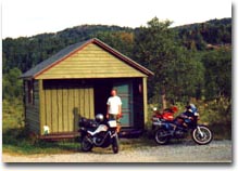
"Where
are we??" Claes wonders
somewhere far out in the "wilderness". |
|
|
Even though the Norwegian accent at this part of Norway is out of this world,
we finally made it to our cabin at around 8:30 pm. The camping site was
situated a couple of hundred meters from a farm, down towards a small lake,
and housed 5 cabins plus a place for tents and caravans. There were not
many guests there though. Not very strange considering we now seemed to
had ended up somewhere in no-man's-land. We paid 250 NOK to the farmer running
the place and invaded the cabin we happened to park our bikes by. After
unpacking our things, we asked the farmer if there was any place nearby
where you could get something to eat at this rather late hour. We had not
eaten since the pizza in Sogndal, so we were quite hungry by now! But the
response was a negative one, as expected. We hoped that there would at least
be a gas station open somewhere around, so we set off on our bikes again.
We drove to the nearby villages and checked, but no luck. It was just as
good to get back to the cabin again and take out all eatable things we had
remaining: a small half eaten package of raisins, half a Mars bar, some
energy pills and water. After this magnificent meal for three persons all
we could do was to get to sleep and try to sleep the hunger off. A good
decent breakfast would have a high priority the following day.
|


